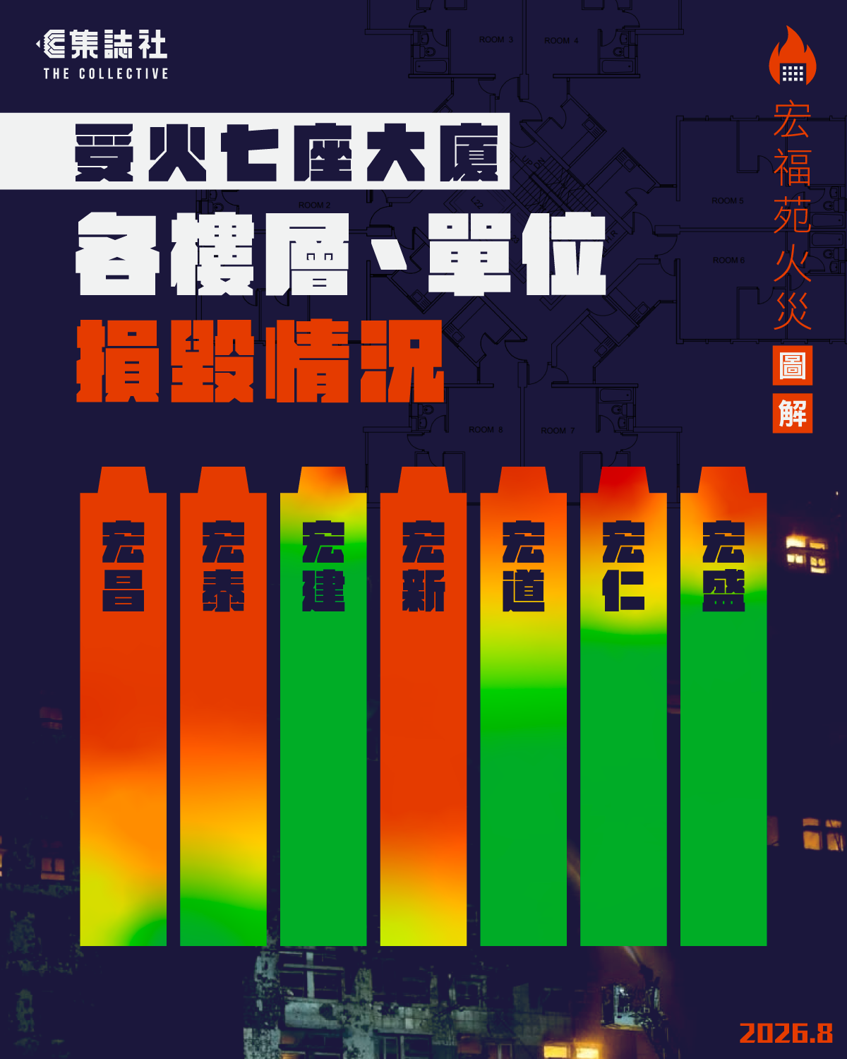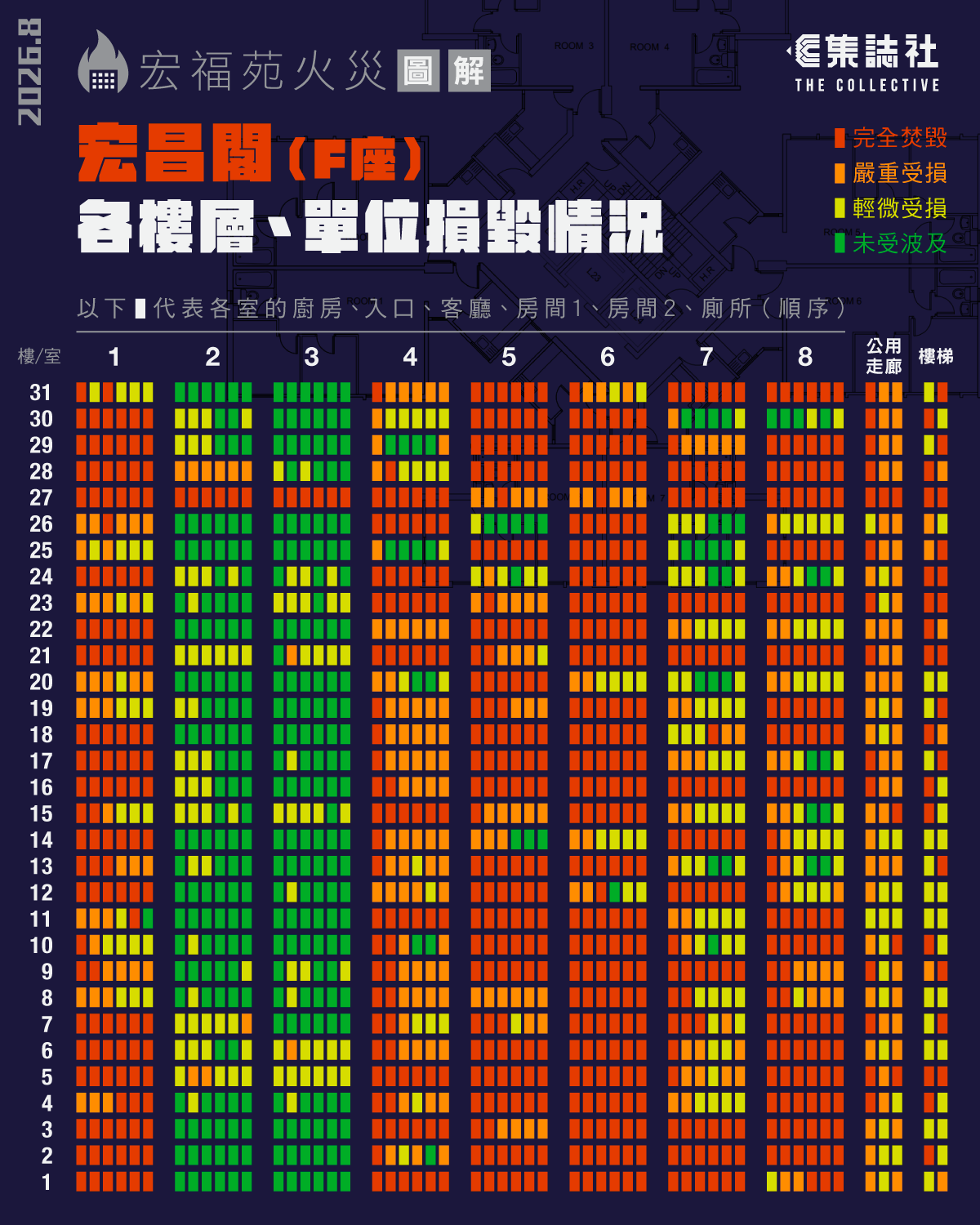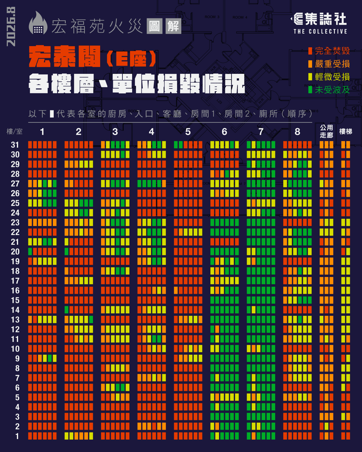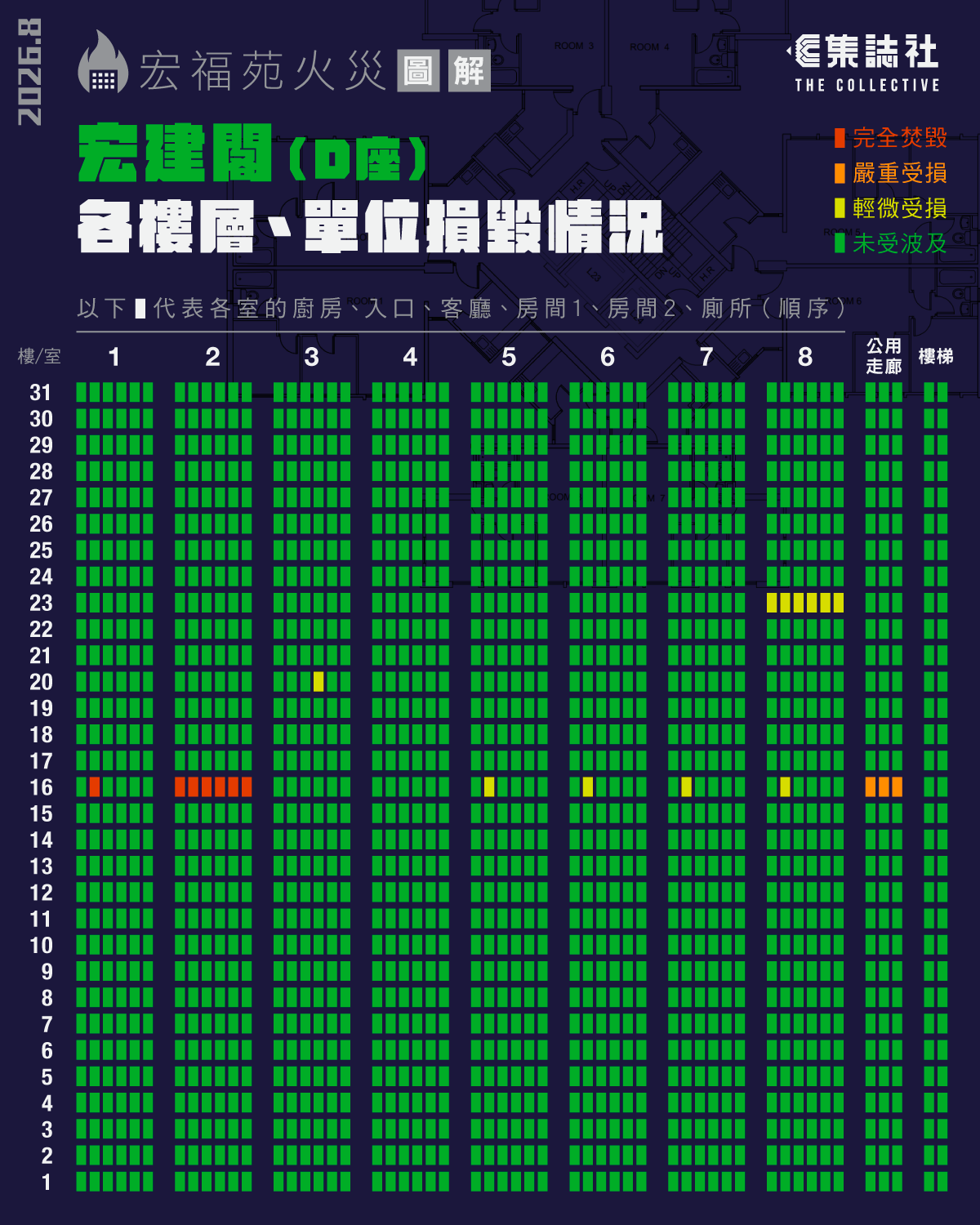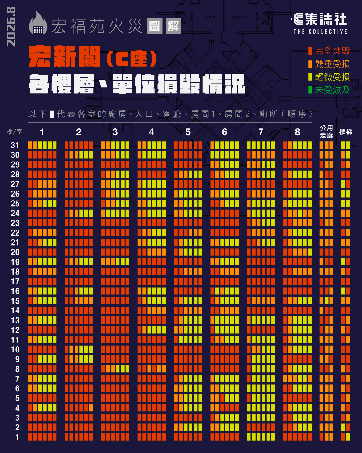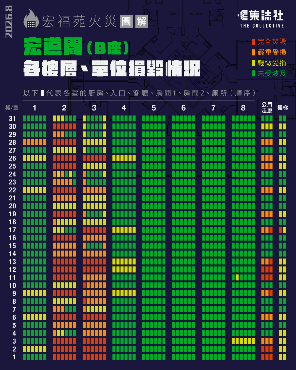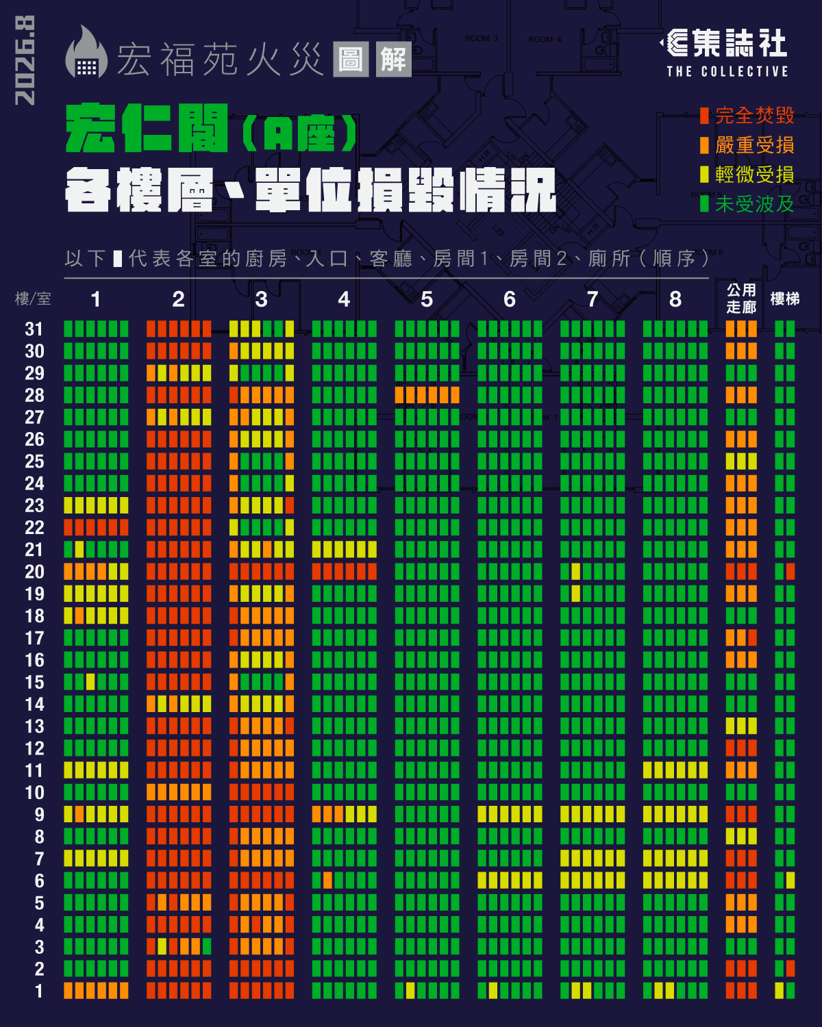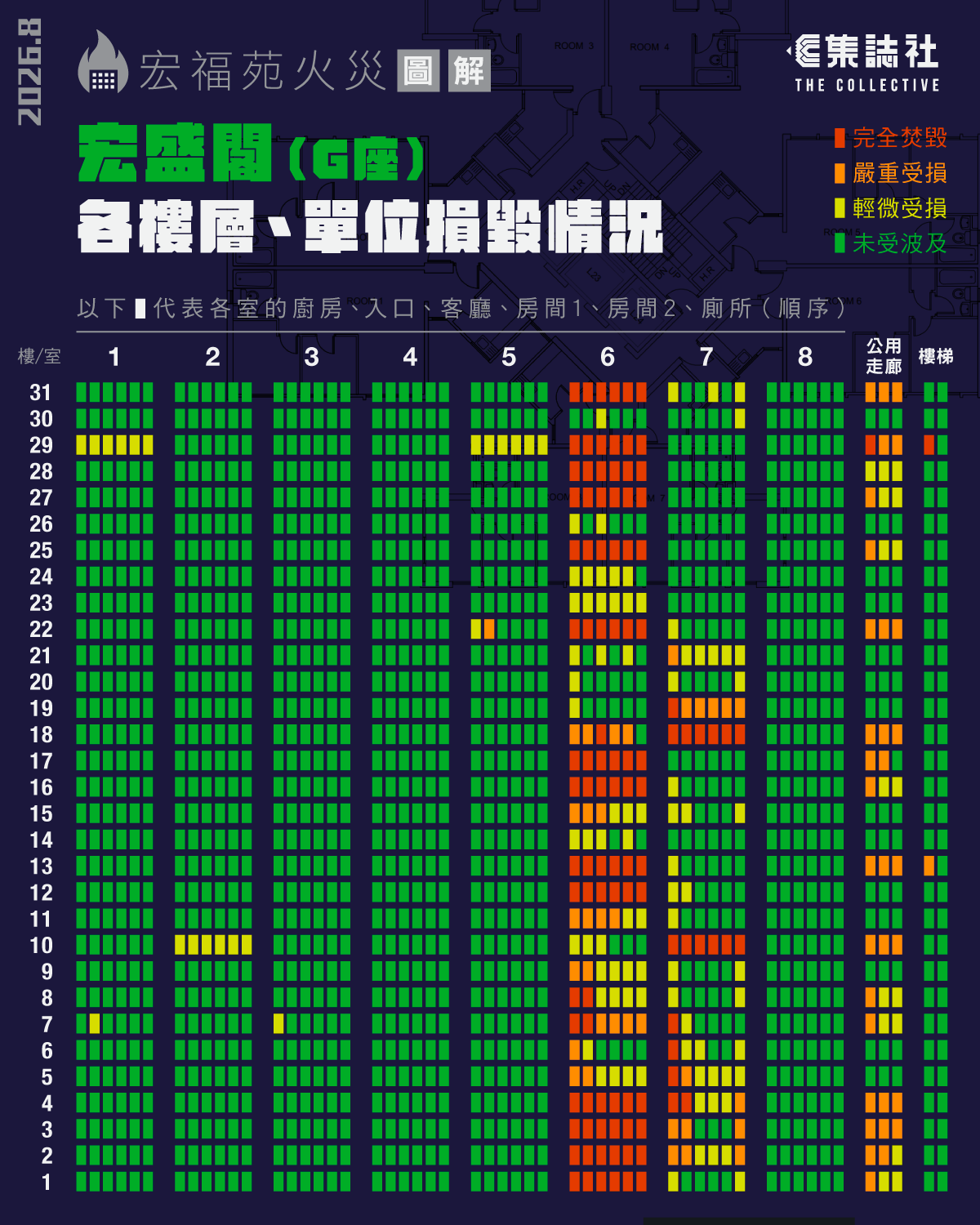
A high-density spatial data investigation for The Collective, mapping floor-, unit-, and room-level fire destruction across 7 residential towers through a micro-grid matrix.
Project Metadata & Logic
Focus: Spatial Data Journalism & Architectural Incident Mapping
Project Objective: To systematically visualize the structural impact of the Wang Fuk Court fire disaster, transforming complex forensic damage records into an accessible, high-resolution spatial data matrix across all seven residential blocks.
Methodology: Multi-scalar visual encoding; micro-level grid mapping (31 floors * 8 units * 6 architectural zones per unit, plus public corridors and stairwells); 4-tier chromatic classification scale (Completely Destroyed, Severely Damaged, Mildly Damaged, Unaffected).
Key Expertise: Architectural Information Architecture, Spatial Data Analytics, High-Density Matrix Design, Visual Data Journalism.